
We didn't have Verizon where we were camped, so no phone or hot spot Internet, but I was able to text. However, the little town of Mt. Carmel Jct., which we could see from our camping spot, had free WiFi at the Thunderbird Restaurant, an easy walk down the road.
Two of the activities planned that I went on were fun and interesting. Some of us planned to visit the Moqui Cave in the morning, then have lunch at Best Friends Pet Sanctuary and take their tour afterward.
First was Moqui Cave. (Click this link for more info.) I went with Elaine, Jan and Larry, who took this photo of us girls in front of the cave entrance:

And here's Jan, Larry and Elaine in another entrance shot:


As you walk into the cave, there is a foyer type room with lots of interesting things on display:


I have to apologize for my pictures of this outing - there was so much to see, so many different kinds of artifacts from dinosaur tracks to Pittsburgh Steelers memorabilia, to Hollywood film photos, and the display of fluorescent fossils and minerals, etc., that I was engrossed in the experience and didn't take many shots. It used to be the only open bar serving liquor in Utah, and the bar and stools are still there, too. It has been in the family for three generations now, and the collections are many. So much to see!
The cave was bought by Garth and Laura Chamberlain in 1951, and they made continuous improvements and additions through the years, with their five children helping them. One of their sons, Lex, and his wife, Lee Ann, took over when Garth died. Some of the WINs met Lex last year when they toured the cave, but unfortunately he has since died as well. His daughter was our tour guide when we went through, and she knew the whole story from the beginning of the cave's history to when her grandparents bought the property, to when her parents owned it and made more improvements, to current days - she was very knowledgeable and interesting. I'm sorry I didn't get her name - beautiful girl, she gave us a great tour.

They are making some improvements outside the cave, and this guy looks like he's a new addition. As we drove by from time to time (they are right on the highway into Kanab), I could see brick walls going up and lots of building activities going on.

Entry price for Moqui Cave is $5, or $4.50 for Seniors. Well worth it!
Next we drove on to Best Friends Pet Sanctuary, where they offer a $5 buffet vegetarian lunch. It was really good, and I ended up going back another day just for the lunch! You can sit inside or out on the large deck with a panoramic view of Angel Canyon.
After eating we went to the visitors center to watch a brief video and then catch the van for our tour, which we had reserved (the tour is free, but they want reservations to make sure they have enough tour drivers and vans available). In front of the visitors center was a beautiful pond with a waterfall, benches, lots of plants and shade - a nice place to sit and rest.

From their website: "1984: The founders of Best Friends Animal Society break ground on their no-kill animal sanctuary in Kanab, Utah. It becomes the nation's largest no-kill sanctuary and Best Friends becomes the flagship for the no-kill movement."
Our driver/tour guide drove us all over the grounds, which were enormous. She told us about the facility's history and what each building or area was for - these are the animal areas:
Best Friends is home to about 1,600 homeless animals from tiny guys to horse size critters: dogs, cats, birds, rabbits, horses, pigs, goats, mules, sheep, burros and wildlife.
All these critters are homeless, and many are ill or abused and in need of loving care and a good home. If a home is not found for them, for any reason, they have a safe haven there for the rest of their lives. Kind of brings tears to your eyes, doesn't it? What a great place this is.
First stop where we could get out was at the Puppy Care Center. We were lucky to be there when they had some puppies that we could visit:


 We also got to go into Cat World where a lot of cats were lounging, walking around, checking out their new visitors, etc.
Look at all the food bowls and dishes drying on the counter:


Toward the end of our tour we got to see some of the larger animals. Horses, donkeys, burros.


The gate above was made by a man who made gates to all the different areas, with each showing what the area is, like cats on the Cat World gate, and dogs on the Dogtown gate. Each was unique and beautiful. If I remember correctly, he donated all the gates to Best Friends.
The facility and all the work and loving care that happens here is set in the gorgeous red rocks and green trees of Utah, everywhere you look is a photo op.

This was an interesting story our guide told us. There are a LOT of volunteers needed to keep the facility open and operating. She said there is one volunteer who felt that there are lots of people who want to help with the animals. She said he's right - many do hands on work, some walk the dogs, some play with the cats, some do clean up, others do laundry for the hundreds of blankets that are washed and dried each day, etc.
Well, this man said he wanted to clear the walking paths of stickers where the animals were exercised by volunteers. So he covers as much ground as he can each visit along the dirt paths and walkways, picking up every goathead and any other sticker he sees that might end up on an animal's foot, or stuck in their pads.
Katie has stepped on goatheads, and so have I - and they HURT. Can you imagine the selflessness of this man, spending his volunteer time bending over again and again and again, picking up goatheads, thorns and stickers so the animals can have a pain-free walk? He truly has a good heart. 💖💖💖
"Best Friends owns nearly 3,700 acres, and we lease another 17,000 acres of state and federal land. Nearly 30,000 people visit every year to meet the animals and tour what has become the nation's largest no-kill sanctuary for companion animals."
They are located at Angel Canyon in the beautiful red rock country of Southern Utah, just outside the town of Kanab. There are lots of beautiful photos of Best Friends here. And more information about Best Friends Pet Sanctuary here if you're interested.
If you are in the area, don't miss the delicious $5 lunch or the wonderful guided tour of Best Friends. (Don't forget to make a reservation - the guided van tour is free.) You won't be sorry, I promise.
From me and Katie and all the friendly critters, have a great day, everyone!
😊❤😸🐶🐭🐷🐰🐸🐔🐏🐃🐴🐐🐢🦃🦎🐍❤😊


![Rock formation X Canyon 1 [800x600]](https://blogger.googleusercontent.com/img/b/R29vZ2xl/AVvXsEgDj6ZMICzC_kbXfR8a_KFsiJruTRxYpDOho_4v1TaRP9S9snEdwYHyD0pU6HLG6TsnPGQZjSH4ir7rKW63W58OfLzU3YYr65LWnpUOGQxrxlBFFEbU3hvRcR03cyxm_d1AsBFAQi-tjLs/?imgmax=800 "Rock formation X Canyon 1 [800x600]")
![Rock formation X Canyon 2 [800x600]](https://blogger.googleusercontent.com/img/b/R29vZ2xl/AVvXsEiQNfyl1NVT1B5xRn6DUnNalNdjmdEp6197WDnQCuXNvj9VXGpPGg_0Hsje8_2MO5mgJss0UFU04c65d8fmAMEGXTf4P3AzseJbAhjmLl_ugbxQoyMZGSKnioYIi5L0sIkB-1EEnz1uQeI/?imgmax=800 "Rock formation X Canyon 2 [800x600]")
![Rock formation X Canyon 3 [800x600]](https://blogger.googleusercontent.com/img/b/R29vZ2xl/AVvXsEiXt2EvbKFsbxpEyVncVtZf4kwcBni1U1XwxNyXUmwscszXFXHBigqBRw-ddtt5ppEMNy6Bvvo78HqgWA1dgO4sp9yFaq41WRGBSaym5B0EMON1dVMlCDNC_csyMx37DcLAOLxISezdnew/?imgmax=800 "Rock formation X Canyon 3 [800x600]")
![Rock formation X Canyon 4 [800x600]](https://blogger.googleusercontent.com/img/b/R29vZ2xl/AVvXsEj_wh8jDVbrrGUT3DFcWJ60WkWMtG3MkgNDdXOSt-Kie1I8u1nscIDoX9iYFpq7gbkeoAio3IKURHUw3a-JTMB6SsPIvcaz7rG3r5kmMf3PDGMUZNGVi9imIx9z2W-qAyRoHgtmfBRL200/?imgmax=800 "Rock formation X Canyon 4 [800x600]")
![Rock formation X Canyon 5 [800x600]](https://blogger.googleusercontent.com/img/b/R29vZ2xl/AVvXsEgdncXZJPRaune3lTJP5LeXZng6tSGEq0XYWNxMyYr6G9RAHA6RWZQLrZRHCofqqAyo6UirD5K5FpahTl5-T70S27dDUKm09svPH6fdR0Y3hieA5iP635EvqY0rhgQfoM2nwqjRXeyOsTg/?imgmax=800 "Rock formation X Canyon 5 [800x600]")
![Rock formation X Canyon 6 [800x600]](https://blogger.googleusercontent.com/img/b/R29vZ2xl/AVvXsEgBA9iA3-x8WycxwCklIbGUt9Zd5T396MfA6iesSxWCcYVexZTK0gRzPEJol70RQqTvyjh50GtsOnPunkb16UUrUHAYC2qdU_BiHpGCXLsshRBll_2fI2kZ2PBPghuP2lr73r0A9VneVqg/?imgmax=800 "Rock formation X Canyon 6 [800x600]")
![Rock formation X Canyon 7 [800x600]](https://blogger.googleusercontent.com/img/b/R29vZ2xl/AVvXsEiVnTWCAXYuBQ1NO0RpcZCcvUd_uEOFdsnpJy0RvXVP84Bgjp-Ryi0YdPmXcAJR5qDF9RUtilw13rdMb9RdE-6dBIGxXJdgNIYcmCOSL36ropRh5Mn8lM1AzHZWMrAFpqgPICa-vRQDSt4/?imgmax=800 "Rock formation X Canyon 7 [800x600]")
![Rock formation X Canyon 8 [800x600]](https://blogger.googleusercontent.com/img/b/R29vZ2xl/AVvXsEgWEsU6Qzo30A9WDsZeZGvmWaD0R2xiIa1Kxn-36tw-uI9bxOtJiPML_g6I-JJjZV9hGl4eOUsSZeAgF9dNbIaTZvV9gjPePsXq7p_Zb8jgTdc0s1wz5jHzNxQEvZHPba1i_vpX62F3PX8/?imgmax=800 "Rock formation X Canyon 8 [800x600]")
![Rock formation X Canyon 20 [800x600]](https://blogger.googleusercontent.com/img/b/R29vZ2xl/AVvXsEgi22QANG7RXonzn0m4zkU0nuwf-g2kkIcG0Yv6XFyCtKtJ9G7uJRjnrW6LDm9dfLx5iVIzqNZS6wqblUGL3k-KxBvksmzA4AyxIK-fQxSRZQhC-S9pbD2bc59TaBuaAaKdnBSchcoSRiw/?imgmax=800 "Rock formation X Canyon 20 [800x600]")
![Rock formation X Canyon 21 [800x600]](https://blogger.googleusercontent.com/img/b/R29vZ2xl/AVvXsEiPsxptpg4AiUmtSkMn71kfIA43Z2bJNr7KJrLm9w-k8zp6KjGYMpFhRbZJO6nwPpFWLC3EFAexwa8lIyKRsG9JOp7_wOjtuCr9aqSqNZlLIlZk0VMUOge-uMCFoerr3OTImAEzg2nODgs/?imgmax=800 "Rock formation X Canyon 21 [800x600]")
![Rock formation X Canyon8 [800x600]](https://blogger.googleusercontent.com/img/b/R29vZ2xl/AVvXsEgy7RjavoVoxgpCMY-IK7dZiaXmLwreTp-svvOml8fizo5PwJPloRdfRGlG5ENxL79vUkTcza1mPXMBcOlvSgWXM5h0ABYmWCqBENH2vPHEANWlW8AlcG25vxmoCwRhW34_Sdxa1X7HhgI/?imgmax=800 "Rock formation X Canyon8 [800x600]")
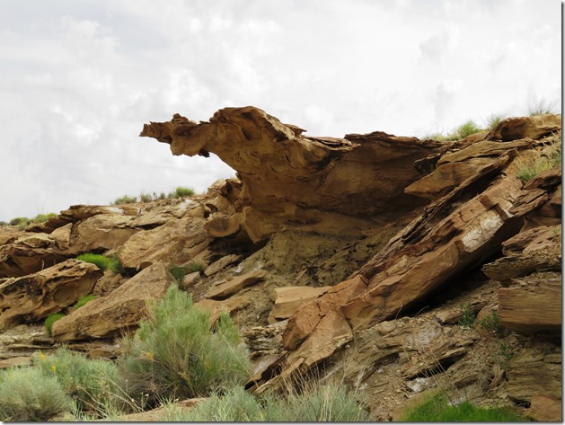
![Rock formation X Canyon9. Indian face profileJPG [800x600]](https://blogger.googleusercontent.com/img/b/R29vZ2xl/AVvXsEiq50F5LmqvGKTxsK3odX6njoFOpGhOMxFAIT6Ltz6ilzZ3gmAsQXx3blSmbzDcTgkwTGajyYHkEyNWpH4TtBJMR59PcVjcuJ04Yuy7N_oHCri_zKlph3kQeMzotlZ1lDeOO6byj4hw8-s/?imgmax=800 "Rock formation X Canyon9. Indian face profileJPG [800x600]")
![Rock formation X Canyon10 [800x600]](https://blogger.googleusercontent.com/img/b/R29vZ2xl/AVvXsEi1bLJ0Lonycz0CigO6oJKLIW_iUI9MgSK9z_37079pan-gAJI6DK0X8hH72ZdVO-v1Z1Lg01NnZ-YNTysGkvf4mSeQoyV9TU7V2HWTDmy0vy0nMhpbkNKkqlW1bxlCX2uqIc5PTCPZLUQ/?imgmax=800 "Rock formation X Canyon10 [800x600]")
![Rock formation X Canyon11 [800x600]](https://blogger.googleusercontent.com/img/b/R29vZ2xl/AVvXsEiH6mXiRSJyn6uPhMuHL_TKI9iiyX1tfcohjNaiy_N1ludsDGPvLgx0MtItz72DA_5Zl5qMZFi_2rrFvmId7bV5hHZDHSH5ARGcWcoPjP1pHGwR47Ptj7zO70szSA_10luS5aQUu3ChvZw/?imgmax=800 "Rock formation X Canyon11 [800x600]")
![Rock formation X Canyon12 [800x600]](https://blogger.googleusercontent.com/img/b/R29vZ2xl/AVvXsEiz6tSaA2OeoSFAnjkek1jy9M2Vs81zMYg5JfTA3atFKCgAUB4vEMePNxC1pZRcK1hDt4Y-HeSM4tjm4v_Mh4pnmvBlqbUap-TFOL2WHbCAMyaorFYAIdEPPRtyfHslNwbIo77fzNlvQNk/?imgmax=800 "Rock formation X Canyon12 [800x600]")
![Rock formation X Canyon13 [800x600]](https://blogger.googleusercontent.com/img/b/R29vZ2xl/AVvXsEg07SzYBUWFQUOTTmYelbJAdRA2cMrOuE9ILqDpLeGAW8SJEOwxi3BQk1FLlgMoWJpBepp7QBDoHNNKHNZaJzHDpslX7N-i_FqOiPhPizImbr33wAQNzWyTTbGzbPhLa9ZhOsf0-yFGjKA/?imgmax=800 "Rock formation X Canyon13 [800x600]")
![Rock formation X Canyon14 [800x600]](https://blogger.googleusercontent.com/img/b/R29vZ2xl/AVvXsEhfiUFTEs2qtW-BEN9JmCagdy2AspDiYQLYceBXKOVqE6FPDXmOU62vZFaXbFQccSDyKFamhHsLtpk62HXYPohWcxLLregl2HLhuGCgsrUHxu6TAB-0f-AqCZnCA_Kva4E9rnZQfXfIJsk/?imgmax=800 "Rock formation X Canyon14 [800x600]")
![Rock formation X Canyon15 [800x600]](https://blogger.googleusercontent.com/img/b/R29vZ2xl/AVvXsEgWUOEHGYqYORCmSzj2J7q6pQv6EVBoOggAW7HRqDDxMTxWm2gxCsOyPCgj0nYZkCoTHabTVDSPbFVOQHCbiHeOpGivM1zQYVrc3Qdbu-0F8jw01u4zDD1ni76WNaK1hqwXVfskSb9fJz0/?imgmax=800 "Rock formation X Canyon15 [800x600]")
![Rock formation X Canyon16 [800x600]](https://blogger.googleusercontent.com/img/b/R29vZ2xl/AVvXsEiTUYA27NTcHpbE9KPdRKbBTSn79Lz6eNiB8eiiV2hnvA9lW63FTN97laCayUR4X64kVNjy55TDQlWGWUZEDXLtXOTghw7OdDOsyRXpYKFOx3dazQIXxq5AS6fg_BtJljf8oO7S-moW6NA/?imgmax=800 "Rock formation X Canyon16 [800x600]")
![Rock formation X Canyon17 [800x600]](https://blogger.googleusercontent.com/img/b/R29vZ2xl/AVvXsEgJN1RGthxfSeGeLE_PRnfu77uGlT8_zBVNLBdRB0v7mMQCAZ4QhKIBd8XlN-RbAPhghJsS0OwF67sPSBNQKthDGfukv5MECnIGngOaFwuPPo4-PK-iR1BkEfUXwcq3xK0PMQjfqYJvjk0/?imgmax=800 "Rock formation X Canyon17 [800x600]")
![Rock formation X Canyon18 [800x600]](https://blogger.googleusercontent.com/img/b/R29vZ2xl/AVvXsEif8uZsVLwA6usqyfoIeLQklvOkoV2goom0SpQGhIpcfH1EIREPdhOq-25bR05VtGQZAcM5AG8k91O4GwD4-WDd98yuft0AhZA251cEXIEZ9Q4yCIizdcMtyxZlMHr_LUkFkezaDPWPuWs/?imgmax=800 "Rock formation X Canyon18 [800x600]")
![Rock formation X Canyon19 [800x600]](https://blogger.googleusercontent.com/img/b/R29vZ2xl/AVvXsEgLwY0PvHP8mMAOzEn74Q8KbYRFejyMwpKBG66388h8K0LjVzp64NCohtmqWRt9ZXLcROZ9JrUT2ZDx9Zmma9RanblTydSBNpXTCPBIj8cLONFR-M8MkX9W_5vaETf7qF5F5Ca9YRS-DSc/?imgmax=800 "Rock formation X Canyon19 [800x600]")